
Explore the Waterway
A 38-mile chain of rivers and lakes from Lake Huron at Cheboygan to Crooked Lake near Conway. Come by boat or by car.
Photo: Indian River from the North Central State Trail, by Tim Kiser (CC BY-SA 4.0).
Michigan's Longest Chain
Michigan's Inland Waterway is the state's longest chain of rivers and lakes. It runs about 38 miles through northern Lower Michigan, from Lake Huron at Cheboygan to Crooked Lake near Conway.
Boaters follow the Cheboygan River, Mullett Lake, Indian River, Burt Lake, Crooked River, and Crooked Lake. Drivers can trace the same path through small towns, state parks, shops, and places to eat and stay.
Water flows from Crooked Lake toward Cheboygan and into Lake Huron. At the Cheboygan end, boaters are about 15 miles from Mackinac Island and about 18 miles from the Mackinac Bridge.
The Route
From Lake Huron, heading inland. Each lake and river has its own page with a map of launches, parks, and places to eat and stay nearby.
Cheboygan River
About 7 miles from Lake Huron to Mullett Lake, through Cheboygan and the Cheboygan Lock.
Mullett Lake
Michigan's fifth-largest inland lake, with Aloha State Park and Topinabee on its shores.
Indian River
About 4 miles of river through the village of Indian River, from Mullett Lake to Burt Lake.
Burt Lake
Michigan's fourth-largest inland lake, home to Burt Lake State Park.
Crooked River
About 6 miles of winding river through Alanson and the Crooked River Lock.
Crooked Lake
The west end of the waterway, with Conway and Oden on its shore.
Pickerel Lake
Joined to Crooked Lake by the Black Hole channel, with Camp Pet-O-Se-Ga.
The U.S. Army Corps of Engineers recognizes 60 inches as a safe navigable depth on the rivers of the Inland Waterway. Depths and conditions change, so check current guidance before you go.
The Locks
Two locks make the trip possible. Both operate seasonally, typically from late spring into fall, and both charge a fee. Hours and fees change from year to year, so confirm the current schedule before you travel.
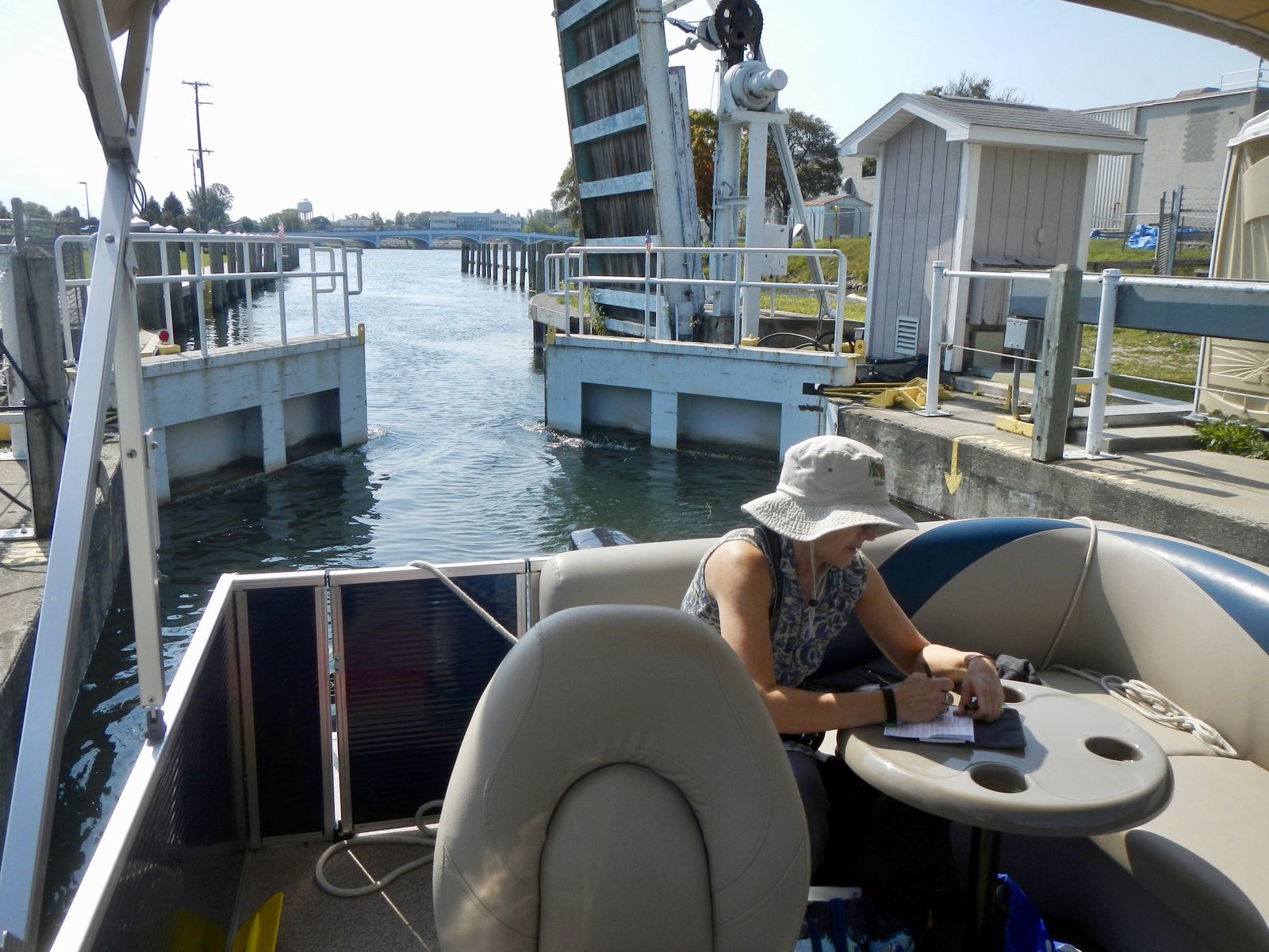
The Cheboygan Lock on the Cheboygan River.
Cheboygan Lock
In the city of Cheboygan, this lock is managed by the Michigan Department of Natural Resources. It can raise or lower boats by as much as 16 feet and can handle watercraft up to 16 feet wide and 75 feet long. A public launch on Lincoln Street sits next to the lock.
Check the official DNR lock schedule for current hours and fees. See the Cheboygan Lock page for more about this stop.
Highlights
- Lift of as much as 16 feet - the larger of the two locks
- Watercraft up to 16 feet wide and 75 feet long
- Lincoln Street public launch beside the lock
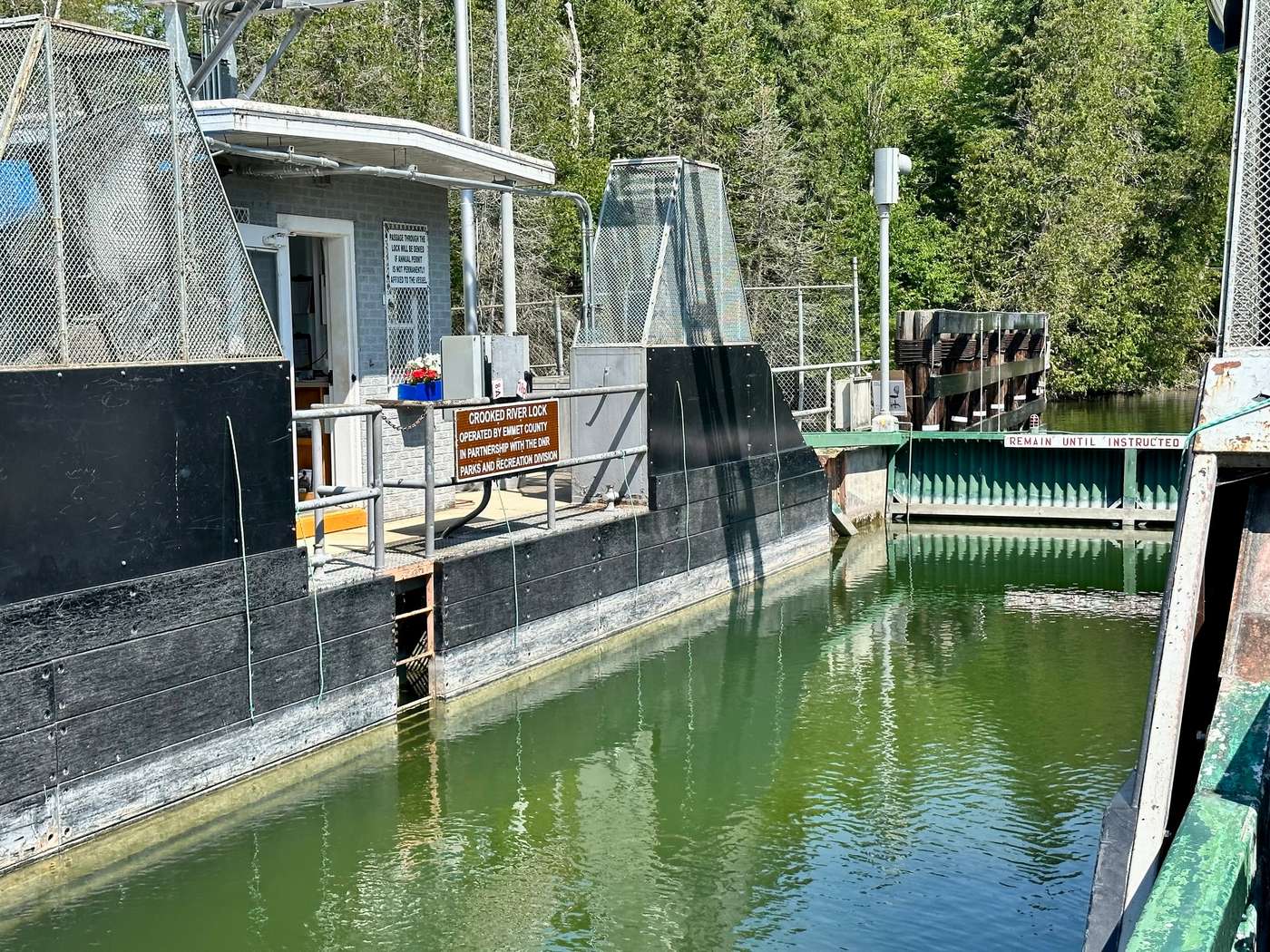
The Crooked River Lock in Alanson.
Crooked River Lock
This lock is in Alanson, at 7983 Lake Street. The U.S. Army Corps of Engineers owns it, the DNR leases it, and Emmet County Parks and Recreation operates it. It helps maintain water levels on Crooked and Pickerel lakes. The lift is usually only a few inches (typically 3 to 12 inches). The chamber is 60 feet long and 17 feet wide, and 7 feet deep.
Check the official Emmet County lock page for current hours and fees. See the Crooked River Lock page for more about this stop.
Highlights
- Small-lift lock that holds water on Crooked and Pickerel lakes
- Chamber 60 feet long by 17 feet wide
- Walkable from downtown Alanson and the Inland Water Route Historical Society Museum
Towns Along the Way
From the Lake Huron end, inland toward Conway and Pickerel Lake.
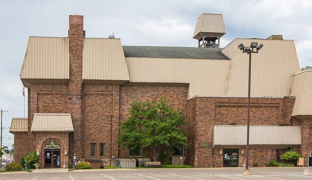
Cheboygan Opera House.
Cheboygan
The waterway meets Lake Huron here. Downtown sits along the Cheboygan River, with parks, the historic Cheboygan Opera House - a 582-seat Victorian theater originally built in 1877 - and the Cheboygan Lock.
At the north end of Huron Street, Gordon Turner Park and the Cheboygan Crib Light look out on Lake Huron. The Cheboygan County Marina is in the same recreation area. Water Street Park, about 2.1 acres on the west bank downtown, has boat mooring and public fishing. The History Center of Cheboygan County is at 427 Court Street.
Cheboygan State Park is a few miles east of town on the Lake Huron shore, about three miles out on U.S. 23.
Highlights
- Cheboygan Lock, Opera House, and riverfront parks
- Crib Light and Gordon Turner Park
- History Center of Cheboygan County and Cheboygan State Park (on Lake Huron)
Directions go to: downtown / Opera House.
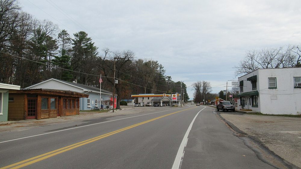
Topinabee.
Topinabee
A small community on the southwest shore of Mullett Lake. It was founded in 1881 with the Michigan Central Railroad; H.H. Pike's hotel opened in 1882. The town is named for a Potawatomi chief.
The North Central State Trail hugs the lake as it passes through town. Topinabee Beach Park has about 400 feet of lake frontage, a small bathing beach, and docks for day use. The original 1881 train depot, purchased by the township in 1958, now houses the Topinabee Public Library, at 1576 N. Straits Highway, with parking off M-27.
Highlights
- North Central State Trail along Mullett Lake
- Topinabee Beach Park, with a beach and day-use docks
- The 1881 depot library
Directions go to: Topinabee Beach Park and depot library.
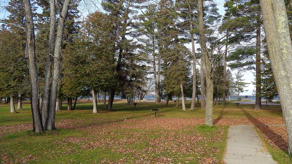
Burt Lake State Park, near Indian River.
Indian River
Set between Burt Lake and Mullett Lake, and named for the river that connects them, this is a natural midpoint for boaters and an easy stop for drivers on I-75.
Nearby are Burt Lake State Park and the National Shrine of the Cross in the Woods, at 7078 M-68. The North Central State Trail has a trailhead here, next to the chamber of commerce. Tuscarora Township's Marina Park and boat launch sit at the meeting of the Indian River and the Little Sturgeon River. Seven Springs Nature Preserve is a short drive away on Chippewa Beach Road.
Highlights
- Burt Lake State Park
- Cross in the Woods
- Marina Park and the North Central State Trail
Directions go to: trailhead / chamber area, S. Straits Highway.
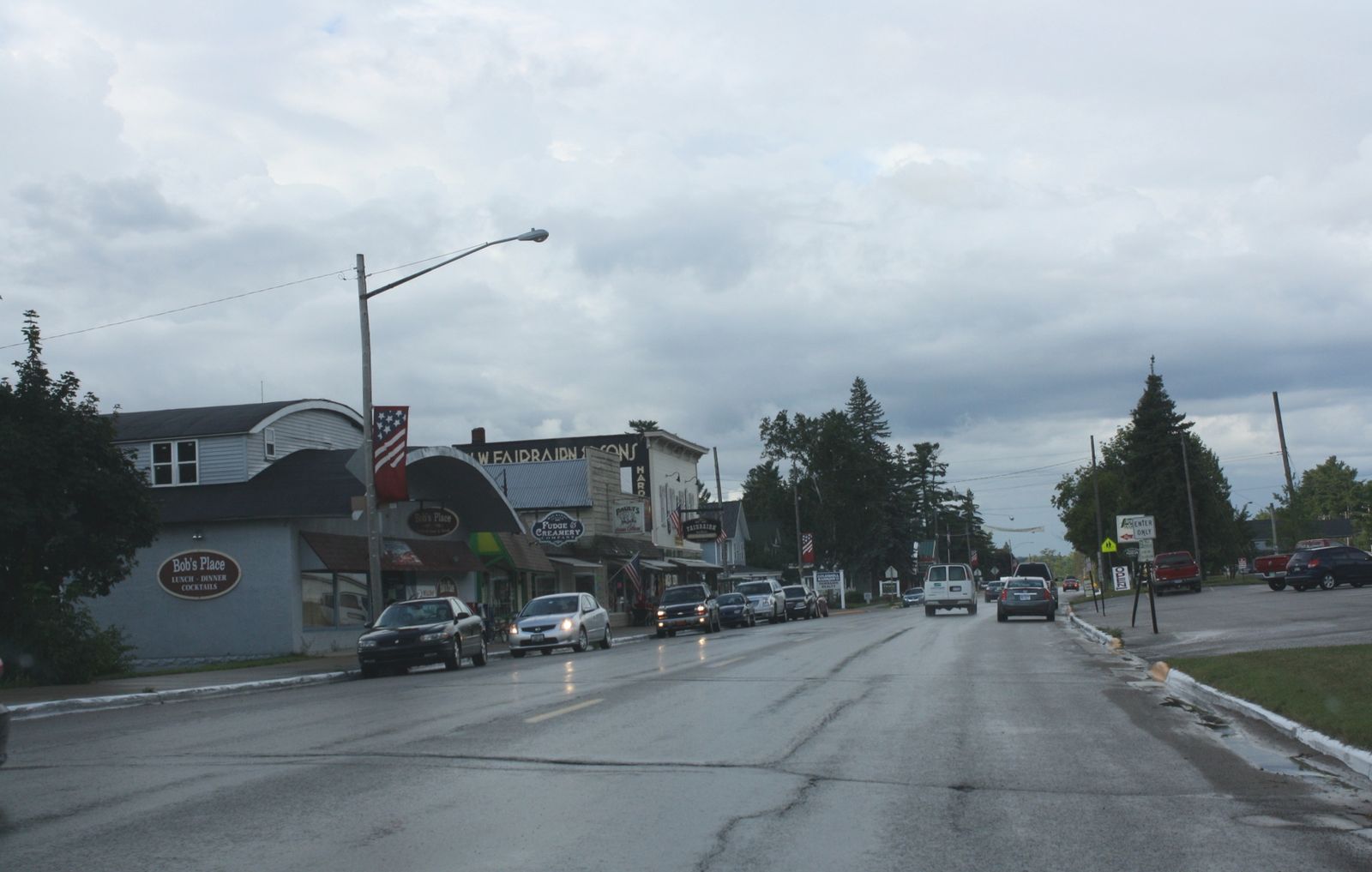
Downtown Alanson on U.S. 31.
Alanson
On the Crooked River, about 10 miles north of Petoskey on U.S. 31 and M-68. The village was first settled in 1875 and incorporated in 1905. Downtown is only a few short blocks, with shops, a river boardwalk, and the Island.
The Crooked River Lock is on Lake Street. A swing bridge on River Street opens for boats in season. The Inland Water Route Historical Society Museum is downtown at 6217 River Street, one block east of U.S. 31, in the historic village hall.
Highlights
- Crooked River Lock
- Inland Water Route Historical Society Museum
- River boardwalk and the River Street swing bridge
Directions go to: village office, U.S. 31.
Oden
A small community on the north shore of Crooked Lake, best known for the Oden State Fish Hatchery. The original hatchery began in 1921; a new hatchery was built in 2002. It raises brown trout and rainbow trout.
Trails and viewing ponds are open to the public year-round. The visitor center, at 3377 U.S. 31, is in the original hatchery building and includes an underwater stream viewing chamber and a historic fish-transport train car. Visitor-center hours are seasonal - check the official DNR page before you go. Oden Island Nature Preserve is nearby on Crooked Lake.
Highlights
- Oden State Fish Hatchery trails and viewing ponds, open year-round
- Visitor center in the original 1921 hatchery building
- Oden Island Nature Preserve
Directions go to: hatchery visitor center.
Conway
Near the west end of Crooked Lake, Conway has long been a gateway to the waterway. It was originally named Crooked Lake, then Dodge's Landing in 1881, and Conway in 1882, the same year it became a station on the Grand Rapids & Indiana Railroad.
Today it remains a quiet starting point for a trip down the chain toward Lake Huron. A Little Traverse Township public launch is at U.S. 31 and North Conway Road, just north of town.
Highlights
- Western gateway of the main 38-mile route
- Township public launch on Crooked Lake
- Historic railroad and landing community
Directions go to: township launch, U.S. 31 at North Conway Road.
Pickerel Lake / Camp Pet-O-Se-Ga
Pickerel Lake connects to Crooked Lake and is part of the Inland Waterway. Emmet County's Camp Pet-O-Se-Ga, a 300-acre public park and campground, sits on its eastern shore. Day use of the park is free. There is a sandy beach, trails, camping, and offshore boat mooring.
A public launch is on Artesian Road, off Ellsworth Road. Ray Johnston Nature Preserve, with more than a mile of trails, is in the same part of the lake.
Highlights
- Camp Pet-O-Se-Ga - 300 acres, free day use
- Sandy beach, trails, and camping
- Artesian Road launch and Ray Johnston Nature Preserve
Plan Your Visit
Come for a day on the lakes, a lock-to-lock cruise, or a drive through the towns along the way. For photos, news, and local updates, follow Northern Michigan's Inland Waterway on Facebook.
Photo credits
“Indian River from the North Central State Trail” by Tim Kiser, CC BY-SA 4.0, via Wikimedia Commons. “Cheboygan Opera House” by rossograph, CC BY-SA 4.0, via Wikimedia Commons. “Close the Lock” (Cheboygan Lock) by PunkToad, CC BY 2.0, via Flickr. Crooked River Lock: U.S. Army Corps of Engineers photo by Brandon Hubbard, public domain, via DVIDS. “Downtown Alanson, Michigan on U.S. Route 31” by Royalbroil, CC BY-SA 3.0, via Wikimedia Commons. Courtesy photos of Burt Lake State Park and Topinabee, Michigan, by Notorious4life, via Wikimedia Commons (CC0).