Northern Michigan's Inland Waterway town guide Little Traverse Bay, next to the west end
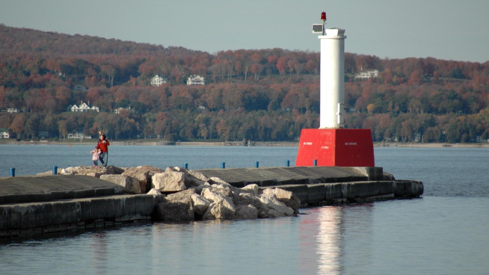
Photo: “Petoskey Light” by abarndweller, Wikimedia Commons, CC BY 2.0, cropped
The bay city next door to Crooked Lake
Petoskey, Michigan
A historic city on the south shore of Little Traverse Bay. Crooked Lake and the start of the Inland Waterway at Conway are about 6 miles up U.S. 31, so Petoskey is the easy base for the waterway’s west end.
Find on mapThings to doTrip planner
Directions: Apple MapsGoogle Maps
Find Petoskey on the map
The map opens on Petoskey and the bay. Tap a pin for Bayfront Park, the city marina, the history museum, the Bear River and Petoskey State Park, then use Show the whole waterway to follow U.S. 31 to Conway and the route east.
Tap a pin for details and directions. Tap a colored button to show only that type of place, tap more to add them back, or tap All to show or hide everything. On a phone, tap the map once before dragging it. Check Driving route in the map key to see the roads that follow the waterway. Use the Map and Satellite buttons to switch views, the arrow button to reset the map, and the expand button for full screen (in full screen, the filter button brings up the place types). Map data © OpenStreetMap contributors; satellite imagery © Esri. Hours, seasons, and fees change, so check each place before you go.
About Petoskey
The basics before you go.
Where it is
On the south shore of Little Traverse Bay in Emmet County. U.S. 31 heads northeast out of town to Conway, at the west end of Crooked Lake, about 6 miles and 12 minutes by car. Alanson is about 11 miles, and Cheboygan, at the Lake Huron end of the waterway, is about 37 miles.
Sources:
City and population
Petoskey is an incorporated city and the Emmet County seat. The official 2020 Census count was 5,877 residents.
Source:
Getting to the waterway
By car: take U.S. 31 to Conway, where the Little Traverse Township Boat Launch, at U.S. 31 and North Conway Road, puts you on Crooked Lake. Parking is limited. By boat: Little Traverse Bay is Lake Michigan water, and there is no navigable channel between the bay and Crooked Lake. The waterway reaches the Great Lakes only at Cheboygan, on Lake Huron, so plan to trailer your boat to Conway.
Sources:
On the bay
The city marina at Bayfront Park has 144 slips, and 72 of them are set aside for transient boats. Petoskey is a Harbor of Refuge, and the marina asks boaters to hail on channel 16. Dates and rates change, so check the marina page before you go.
Source:
Petoskey history
How the bay and the waterway have always been close neighbors. Each milestone links to its source.
Long before the survey
A short portage to the bay
By following the Cheboygan River, Mullett Lake, the Indian River, Burt Lake and the Crooked River up to Crooked Lake, Native travelers and fur traders had only a short portage left to Little Traverse Bay. It let them skip the trip through the Straits.
Source:
1869
A lock opens the waterway to steamers
A lock on the Cheboygan River opened the route to the vessels of the Cheboygan Slack Water Navigation Company, which carried passengers and freight until the railroads put it out of business. Day-long excursions became popular with tourists.
Source:
1873
The settlement on the Bear River becomes Petoskey
The settlement was named for Pet-O-Sega, an Odawa leader whose name is often translated as “rays of the rising sun.”
Source:
1882
The Fishing Line
The Grand Rapids & Indiana line, later known as “The Fishing Line,” opened north from Petoskey through Alanson. The same year, the settlement at the west end of Crooked Lake became Conway, a station on the railroad.
Sources:
1899
A light on the breakwater
A light was established on the Petoskey breakwater. The pierhead light still marks the harbor entrance at Bayfront Park.
Source:
1965
The Petoskey stone becomes the state stone
The fossil coral Hexagonaria percarinata, found along the bay, became Michigan’s official state stone.
Source:
Things to do in Petoskey
The bay and the river in town, then the trail and the road to the waterway’s west end.
Bayfront Park
A reclaimed industrial site turned into a 25-acre park with 7,800 feet of public shoreline on Little Traverse Bay. The marina and the breakwall are right there.
Source:
The marina and the breakwall light
Transient slips, a Harbor of Refuge, and a breakwall with a light that has marked the harbor since 1899. It is a good place to watch boats come in off the bay.
Sources:
Look for Petoskey stones
The state stone is a 350-million-year-old fossil coral. The Visitors Bureau says Lake Michigan beaches are the most popular place to hunt for them, especially in spring after the ice has churned the shore.
Source:
Bear River Valley
A 36-acre park along 1.5 miles of the Bear River, with paths, lookouts and a quarter-mile whitewater course. The city says the Bear River has more fall than any river in the Lower Peninsula.
Source:
Petoskey State Park
About a mile of sandy Lake Michigan shore on Little Traverse Bay, with dunes, trails and two campgrounds, about 3 miles northeast of town. A Recreation Passport is required.
Source:
North Western State Trail to Alanson
The 32-mile rail-trail follows the old Fishing Line from Petoskey to Mackinaw City. The 7 miles from M-119 in Petoskey to Powers Road in Alanson are paved, so you can ride to the Crooked River.
Source:
Little Traverse Wheelway
A 26-mile paved trail around the bay from Charlevoix through Petoskey to Harbor Springs. Part of the bluff section between East Park and Magnus Park has been closed by erosion, so check conditions before you ride.
Source:
Launch onto Crooked Lake at Conway
About 6 miles up U.S. 31, the township launch at Conway puts you on Crooked Lake at the start of the navigable waterway. From there it is lakes, rivers and two locks all the way to Lake Huron.
Sources:
Where to eat and stay
Petoskey has far more restaurants, hotels and inns than any town on the waterway, from downtown to the bay. Rather than repeat lists that change every season, we point you to the people who keep them current.
Petoskey Area Visitors Bureau
The area’s official listings for places to eat and places to stay, plus the events calendar.
Hours change with the season. Check each place before you go.
Pair it with the Tunnel of Trees
Our sister site covers Petoskey from the driver’s seat. The Tunnel of Trees scenic drive on M-119 starts at the edge of town and follows the Lake Michigan shore north through Harbor Springs. Its Petoskey guide has the downtown, the Gaslight District and more places to eat and stay.
Plan your trip to Petoskey
Head up U.S. 31 to Conway, Oden and Alanson, or follow the whole route on the Inland Waterway map.
Visitors BureauCity of PetoskeyTrip planner
Nearby towns
On the water
Hours, seasons, marina dates, lock schedules and menus change. Check each place before you go.